There’s a specific kind of Japanese geography that doesn’t appear in the Kyoto or Tokyo tourist posters. You’ll find it on the overnight train from Osaka, pressed against the window at dawn, as the mountains start rising out of the mist and the sea appears and disappears between the trees. You’ll find it on the bus from Hiroshima Airport, threading up a pass between two 800-metre peaks that were forested continuously since the last ice age. You’ll find it on a rented bicycle on the Shimanami Kaido, halfway between Honshu and Shikoku, on a bridge a hundred metres above an island the size of a supermarket car park.
This is the Chūgoku region — the western third of Honshu, the five prefectures of Hiroshima, Okayama, Shimane, Tottori, and Yamaguchi — and the landscape that defines it is genuinely unusual by Japanese standards. Almost nowhere else does the country compress so many different geographies into such a small area: an inland sea that behaves like a lake, two parallel mountain ranges that split the region north-south, an active volcano visible from offshore islands, the largest karst plateau in East Asia, 400 kilometres of Sea of Japan cliffs, and — inland — the only real sand dunes in the entire country.
This page is the overview. If you’re trying to understand how the region fits together, or which bit of it to visit for what, start here. Links at the bottom of each section take you to the full guides.
The shape of the region
Chūgoku is built around two mountain ranges running east-west in parallel, with a trough of flat land between them that most of the population lives in. The Chūgoku Mountains (中国山地) form the central spine — ancient, worn-down peaks in the 800–1,300 metre range, covered in cypress and beech. Nothing volcanic, nothing alpine. What you get instead is a geography of rounded ridges, river-valley villages, and passes that local trains grind up in second gear.
On the south side of this spine is the Setouchi coast — the 450-kilometre shoreline of the Seto Inland Sea, warmer, flatter, historically where most of the cities and ports grew. On the north side is the San’in coast — the Sea of Japan side, cooler, wetter, cliffier, and emptier. The climate difference across 60 km is remarkable. Hiroshima in February gets almost no snow. Tottori in February gets enough to close rail lines.
If you’re trying to build a regional itinerary, the most important navigational fact is this: the Shinkansen runs along the south (Setouchi) coast. There is no Shinkansen on the San’in side. If you want to visit Izumo Taisha, the Hagi samurai district, or the Tottori sand dunes, you’re taking local trains and buses, and the journey itself becomes part of the trip. This is usually a good thing.
The Setouchi: an inland sea that thinks it’s a lake
The Seto Inland Sea (瀬戸内海) is what defines most people’s mental image of Chūgoku. It’s technically an inland sea, but practically a warm, low-current, island-strewn lake — 450 km long, roughly 15–50 km wide, enclosed by Honshū to the north, Kyūshū to the west, and Shikoku to the south. About 700 named islands sit in it, most of them uninhabited. Humans have lived on the shores of this sea for 2,000 years continuously. It shows.
The defining physical feature is the calm. The Setouchi is sheltered on all sides from the Pacific and the Sea of Japan. The tides rise and fall quietly. The light off the water has a specific milky quality that every Japanese photographer recognises. The oyster farms that cluster in the shallows — some of the best in the world, as any Hiroshima menu will tell you — work partly because the water almost never moves.
What to do in the Setouchi region:
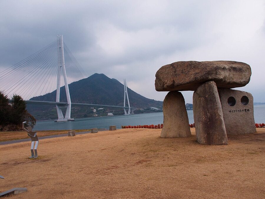
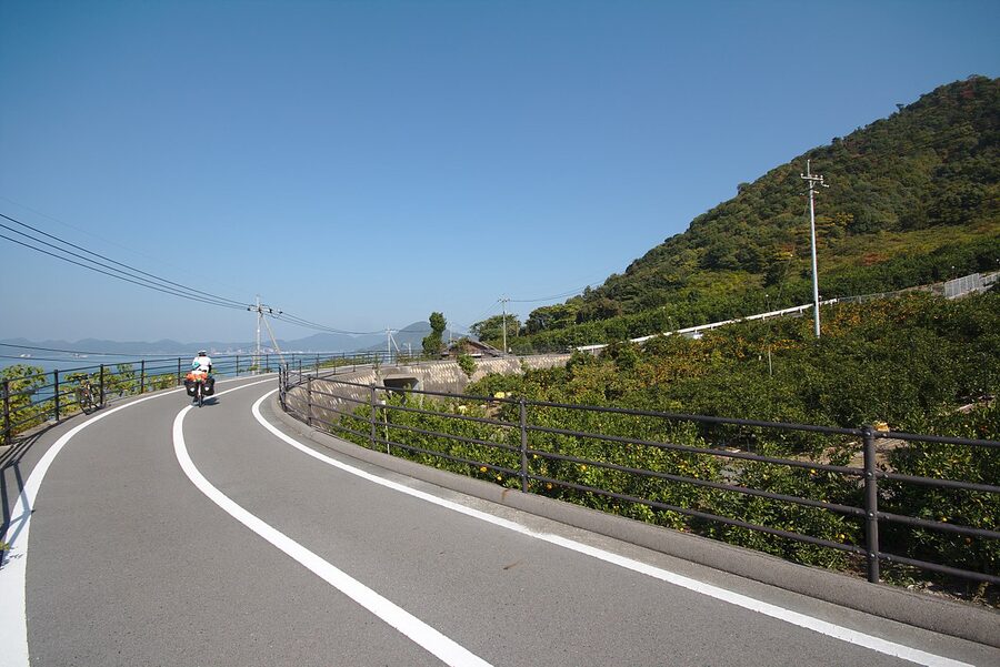
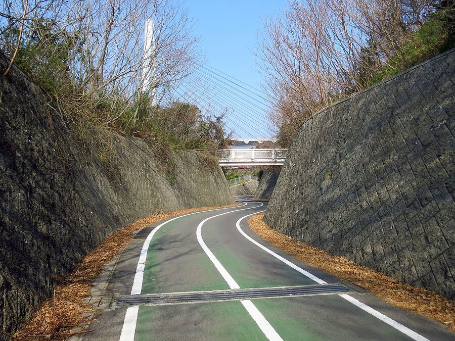
The Shimanami Kaidō cycling route is the headline experience. Start early from Onomichi, rent a bike (¥1,000/day, ¥1,500 electric), and ride over six separate bridges to Imabari on Shikoku. Even if you’re not a cyclist — you don’t need to be — this is a genuinely great day.
For a slower, older Setouchi experience, Mihara and its ferry connections work well. The little-known port-and-castle-town is 30 minutes east of Onomichi on the Kodama Shinkansen and ferries from there hit the northern Shimanami islands as a day trip.
Further east on the coast, Kurashiki — the preserved Edo-era canal quarter — is where you go for urban Setouchi. And Okayama is the regional capital and the Shinkansen hub.
For the Setouchi’s specific food culture — the oyster rafts off Hiroshima, the conger-eel and sea bream of the island villages — our Hiroshima oysters piece covers the season and the serving styles.
The San’in coast: the other Japan
Cross the mountains to the Sea of Japan side and the whole character of the region changes. Fewer cities, more villages, sharper weather. The San’in coast (山陰) runs for about 400 km from Tottori in the east to Shimonoseki at the western tip, and it’s where you go in Chūgoku for landscape as the primary experience rather than cities.
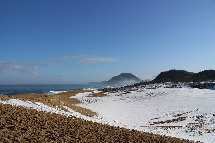
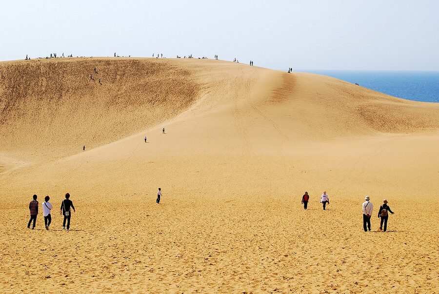
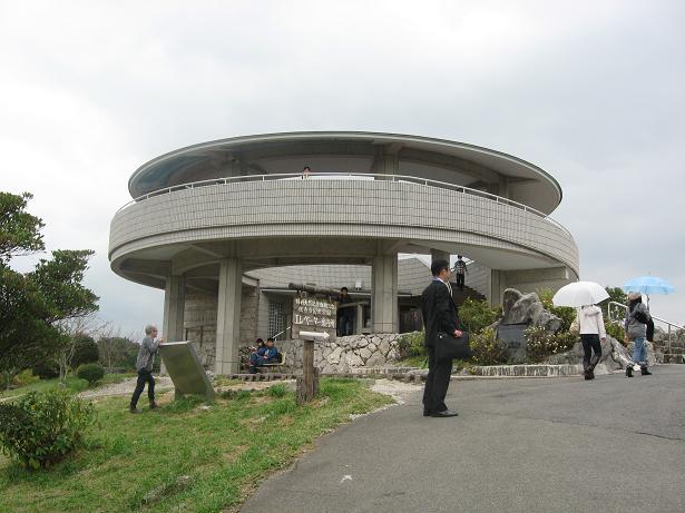
Tottori Sand Dunes. The single most unexpected geography in Japan. You round a bend on the San’in Main Line local train and suddenly you’re looking at a proper desert — 16 km of sand rolled up against the sea, shifted around by wind, with dunes that the wind reshapes every week. The largest of them is 50 metres tall. You can climb any of them. On a summer weekend there are camels, which is ridiculous but true. Tottori Station to the dunes is a 20-minute bus; entry to the dunes is free.
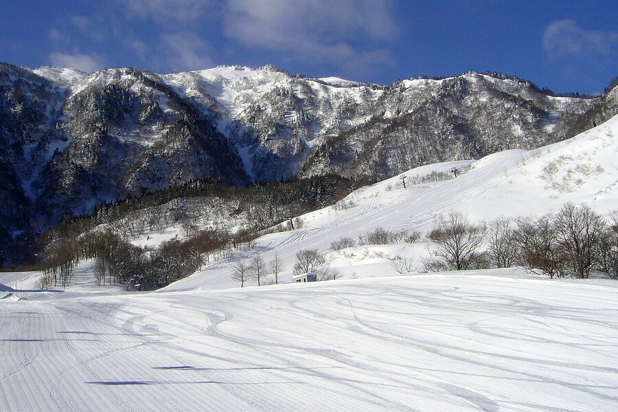
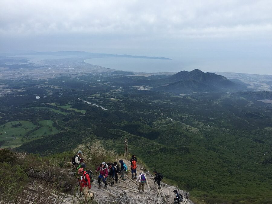
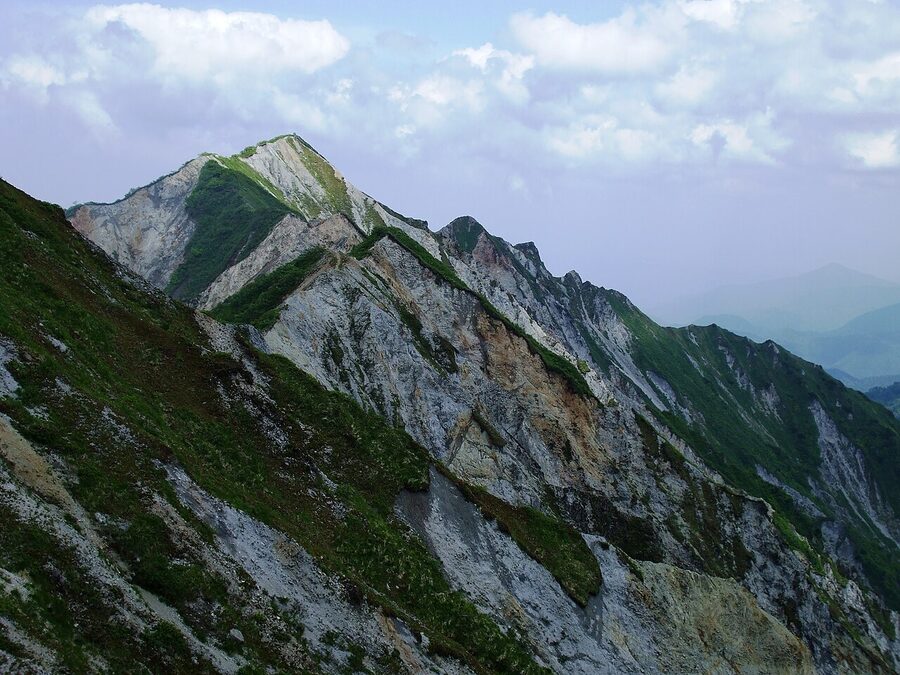
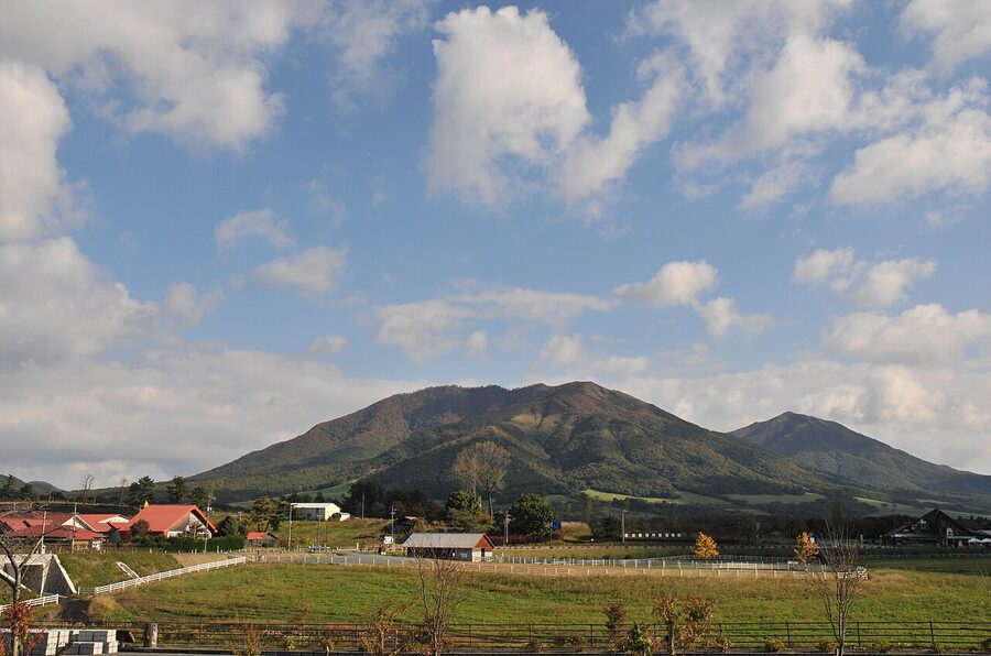
Mt Daisen. Half an hour west of Tottori city, Mt Daisen (大山, 1,729 m) is the Chūgoku region’s only serious mountain. It’s an extinct stratovolcano with a near-perfect conical silhouette, visible from 50 km out on a clear day, and it’s a proper alpine hike in summer (4 hours up, 3 down, cedar and beech forest below 1,200 m, alpine scrub above). In winter it’s a small but legit ski resort. The eastern approach from Daisen-ji temple is what most Japanese hikers take.
Izumo and the San’in. Further west on the same coast sits Izumo — home of Izumo Taisha, the oldest major Shinto shrine in Japan, and the stretch of coast around it (Inasa Beach, Hinomisaki Lighthouse) is genuinely beautiful in a way the guidebooks undersell.
Hagi and the western coast. At the far western end of the San’in sits Hagi, the former samurai capital of the Chōshū domain. The landscape around it — fishing coves, small islands, the Motonosumi Inari shrine’s torii gates running down to the sea — is the San’in at its best.
The San’in line: what the journey actually looks like
The JR San’in Main Line is the single rail line that runs along the entire San’in coast, from Kyoto in the east to Shimonoseki in the west. In principle you can take this line end-to-end in about 12 hours of sitting on local trains. In practice, it’s one of the best multi-day train experiences in Japan, and it’s essentially empty of other tourists because nobody on a typical Japan itinerary is doing this route.
A few specifics about the experience:
The trains are local. There are limited-express services on parts of the line — the Super Hakuto between Kyoto and Tottori, the Matsukaze between Yonago and Masuda, the Super Oki Izumo to Masuda — but there are large sections that only have local service. The old two-carriage rural train will stop at every station, some of which are just a platform in a rice field.
The scenery alternates. East of Matsue the line runs directly alongside the Japan Sea for long stretches, with wave-cut platforms below the tracks. West of Matsue it moves slightly inland through rice paddies. Around Hamada and Masuda it passes close to the cliffs again. The ride is almost always a window-seat proposition.
Fuel the trip at the stations. Half of the stations on the San’in line have small ekiben (station bento) stalls selling local specialty lunches — the cold crab bento at Tottori, the ika-meshi squid at Susa, the mamakari pickled herring at Yonago. The Yonago Station shop has maybe the best ekiben range in the prefecture.
Where to break. Don’t try to do the whole line in one day. Plan four or five overnights: Tottori, Matsue, Izumo, Masuda, and Hagi are the natural stops. Each has enough to fill at least a day; each has sane hotel options.
Pass recommendation. The JR West San’in-Okayama Area Pass is the relevant discount product: 4 days of unlimited travel on the San’in line and related branches plus the Shinkansen back from Okayama, ¥5,000. Buy it at any JR West ticket office or online. Only available to foreign passport holders.
The Inland: karst, plateau, rice, and river valleys
Between the two coasts, at the spine of the region, the mountains compress into a series of plateaus and karst landscapes that almost nobody outside Japan visits. These are quiet, rural, and geologically unusual.
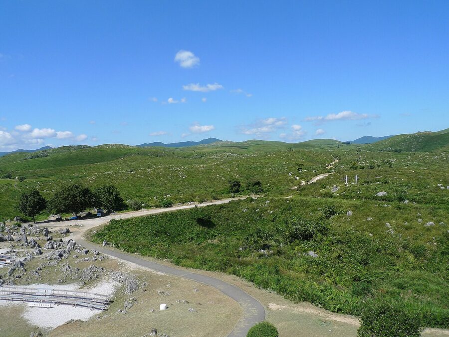
Akiyoshidai karst plateau. An hour inland from Yamaguchi city, the Akiyoshidai (秋吉台) is one of the largest karst landscapes in East Asia and Japan’s only major one. The limestone outcrops you see across the plateau are what remains of an ancient coral reef that was thrust up onto land when Japan split from the Asian mainland 35 million years ago. Beneath the plateau sits Akiyoshidō cave — Japan’s longest cavern, 10 km in total, of which the public can walk 1 km. The cave has a year-round temperature of 17°C, which makes it a strange respite in August. Bus from Yamaguchi Station to the plateau entrance, about 80 minutes, ¥1,150. Cave entry ¥1,300.
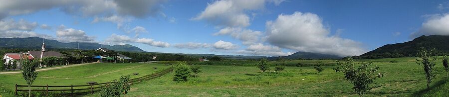
Hiruzen plateau. In northern Okayama, at the base of Mt Daisen’s southern flank, sits Hiruzen (蒜山) — a 500-metre-high rolling-pasture plateau that was dairy country for the Ikeda clan in the 19th century and remains the only real “highland meadow” landscape in western Japan. This is where Okayama’s famous Jersey milk comes from. The pastures are open, rolling, full of cows in summer, and deeply snowy in winter. In early spring the rape-flower fields bloom yellow across about 30 km² of the plateau.
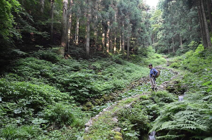
River-valley villages. In the quieter inland corridors of the Chūgoku Mountains, you’ll find an entire sub-genre of traditional Japanese landscape: narrow river valleys with single-file strings of wooden houses, terraced rice paddies climbing the slopes, and a main street that’s one lane wide. The best-preserved examples are the town of Tsuyama, which is technically a castle town but surrounded by this river-valley country, and the more remote villages around Shiso and Yubara onsen in northern Okayama.
Four landscape itineraries that actually work
The classic Setouchi loop (5 days, Shinkansen + ferry). Osaka → Okayama (Kurashiki + Okayama city, 2 nights) → Hiroshima + Miyajima (1 night) → Onomichi / Shimanami Kaidō cycling day → Hiroshima → Osaka. Heavy on coast, history, and oysters.
The San’in coast alternative (5 days, rental car or train-and-bus). Hiroshima → Hagi (2 nights) → Motonosumi + Tsunoshima → Izumo (1 night) → Matsue → Tottori Sand Dunes → back. Slower, quieter, less food-famous, more dramatic landscape.
The inland plateau + castle loop (4 days, rental car essential). Okayama → Tsuyama → Hiruzen plateau (overnight at Hiruzen Highland Resort) → Mt Daisen → down to Matsue → Izumo → back via the San’yō coast. The mountain version of the region.
The all-five-prefectures 9-day deep loop. Osaka → Okayama (Kurashiki) → Hiroshima → Shimanami cycling → Yamaguchi (Akiyoshidai + Hagi) → Izumo (Izumo Taisha + Inasa) → Matsue (garden + castle) → Daisen hike → Tottori Sand Dunes → back via Himeji. This is the comprehensive version. You need a rental car for half of it.
When to visit
The Chūgoku region has four distinct seasons and each one changes the landscape dramatically.
Spring (late March – May). The cherry blossom week is the region’s peak — Okayama’s Kōrakuen, Hagi Castle walls, Tsuyama’s 1,000-tree Kakuzan Park, Mihara’s castle tenshudai. The peak is usually the first week of April. Hiruzen’s rape flowers take over from late April.
Summer (June – August). Rainy season hits in mid-June and doesn’t let up till mid-July. Then it gets hot and humid — 33°C and 70% humidity in the Setouchi valleys. The San’in coast is cooler. The mountains (Daisen, Hiruzen, the Chūgoku peaks) are a good escape. The Shimanami Kaidō is rideable but sweat-drenched. Festivals run through August — Yassa Matsuri in Mihara, Izumo’s Kamimukae-sai in October.
Autumn (October – November). The best season. Temperatures drop to 18–22°C, the autumn leaves run from mid-October at Daisen’s summit down through November in the valleys. Kōrakuen, Buttsuji Temple above Mihara, the Akiyoshidai grasses, and the maple trees at Shūraku-en in Tsuyama all peak in the second or third week of November. Plan for this if you can.
Winter (December – February). The San’in side gets proper snow — Matsue and Izumo regularly have 30 cm or more in January. The Setouchi side barely gets any. Mt Daisen is a ski resort from December to late March. If you want a Japan trip without crowds, late January and February in Chūgoku is a genuine option.
Getting around the landscape
By Shinkansen. The San’yō Shinkansen runs Osaka → Himeji → Okayama → Hiroshima → Shin-Yamaguchi → Hakata (Fukuoka). Every major Setouchi-coast city is accessible. The San’in side has no Shinkansen at all.
By local train. The San’in Main Line is the workhorse — a scenic, slow, coast-hugging line that connects Kyoto → Tottori → Matsue → Izumo → Hagi → Shimonoseki. If you ride the whole thing end to end, it’s about 12 hours and one of the best value train journeys in Japan.
By car. Genuinely recommended for the inland and San’in portions. The Chūgoku Expressway cuts across the mountains and connects most of the region’s interior. Rental from Hiroshima, Okayama, or any major airport; about ¥8,000/day for an economy compact.
By ferry. Multiple daily services connect Hiroshima ports to Matsuyama on Shikoku, and the Shimanami islands to Onomichi and Imabari. Worth doing once for the view.
One landscape moment that sticks
Every traveller I’ve sent to Chūgoku comes back with a different moment. Nobody’s is the same. One friend remembered late-afternoon light over a rice paddy near Tsuyama. Another remembered fog coming down over the Fudekageyama viewpoint in Mihara as the ferries threaded between the islands. Another remembered standing on the Tottori dunes at dawn with the wind erasing her footprints as she made them.
Mine is the view from Mt Daisen’s eastern ridge at about 6 am in October. The Sea of Japan is visible to the north. The Seto Inland Sea is visible to the south. You are standing on an 1,700-metre volcano that sees both coasts of Japan in a single rotation. The light is flat and cool and it turns the whole Chūgoku region underneath you into what it actually is: the narrow bridge between two seas, holding up a thin spine of mountain, covered in 2,000 years of human settlement.
Visit once and you’ll come back. That’s the promise this region has always made.