From the 8th century until the Meiji Restoration, the Oki Islands were Japan’s official exile destination for inconvenient people. Two former emperors were sent here when they’d lost political battles — Go-Toba in 1221 (he never left, died on the island in 1239) and Go-Daigo in 1332 (who did escape, a year later, and went on to briefly overthrow the shogunate). Between them, and before, and after, a long list of Heian courtiers and Kamakura warriors found themselves on a one-way boat from the mainland, 60 km out into the Sea of Japan, to a small cluster of volcanic islands with no way back.
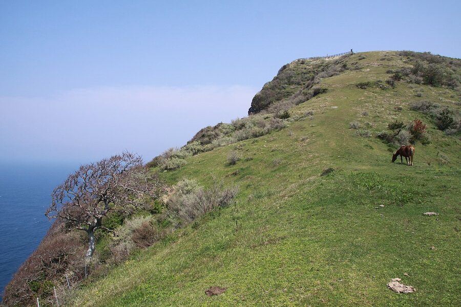
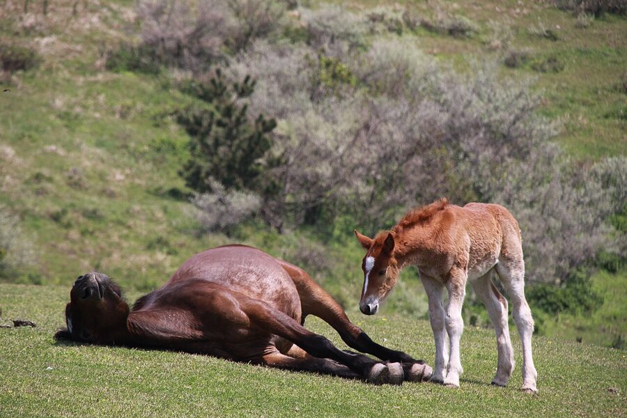
If that sounds depressing, it shouldn’t. The Oki Islands (隠岐諸島) are one of the most spectacular places in Japan: a UNESCO Global Geopark, a collection of four main inhabited islands carved from an extinct caldera 6 million years old, with 260-metre sea cliffs, wild horses grazing on exposed grass slopes, year-round bull-sumo tournaments, open-sky Shinto festivals, and the kind of coastline you walk for an hour without seeing another human. The emperors had bad taste.

This guide covers what the four main islands are, how to actually get there (no easy answers — you either fly or take a four-hour ferry), what to do on each, and how to assemble two or three days that will make this the most talked-about stretch of your Japan trip.
Geography: what the four islands actually are
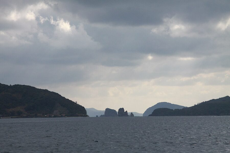
The Oki group sits 60 km offshore of the Shimane coast, in the Sea of Japan. There are about 180 individual islands in total, but only four are inhabited, and they split naturally into two subgroups:
Dōzen (島前) — “front islands” — three islands arranged around a central bay that is in fact the flooded caldera of an extinct volcano. They are: Nishinoshima (the westernmost, largest), Nakanoshima (the middle one, also called “Ama town”), and Chiburijima (the southern one, smallest inhabited).
Dōgo (島後) — “back island” — a single larger island 17 km east of the Dōzen cluster. Circular, roughly 30 km across, by far the most populated, and the main administrative centre of the islands. Saigō on Dōgo is the arrival port for most visitors.
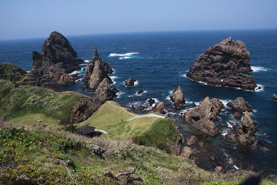
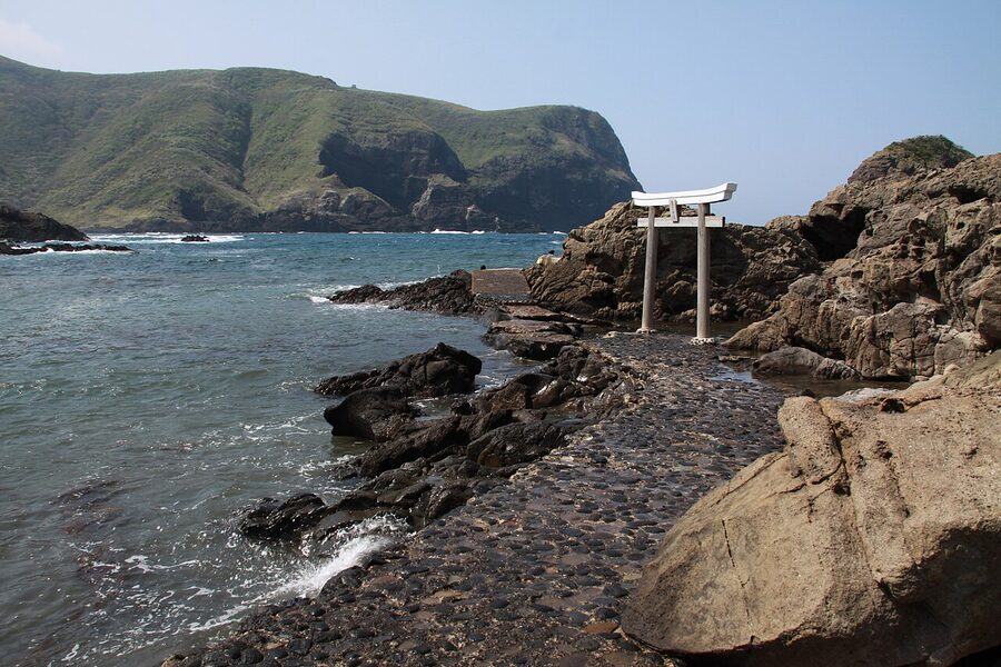
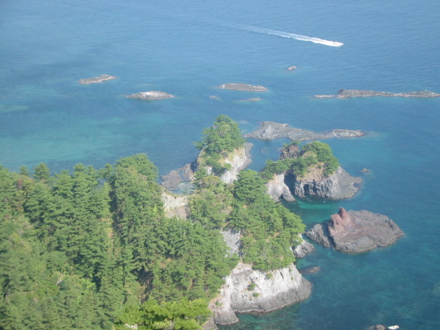
The islands are a UNESCO Global Geopark — officially designated in 2013 — because of their geological history. They formed between 6 and 0.5 million years ago as a series of submarine volcanoes. The extinct caldera of the main stratovolcano is what now holds the Dōzen bay. The Matengai cliff and Rōsoku-jima sea-stack are directly exposed sections of that old volcanic interior. The Kuniga coast of Nishinoshima has some of the best-exposed columnar basalt in East Asia.
Getting there
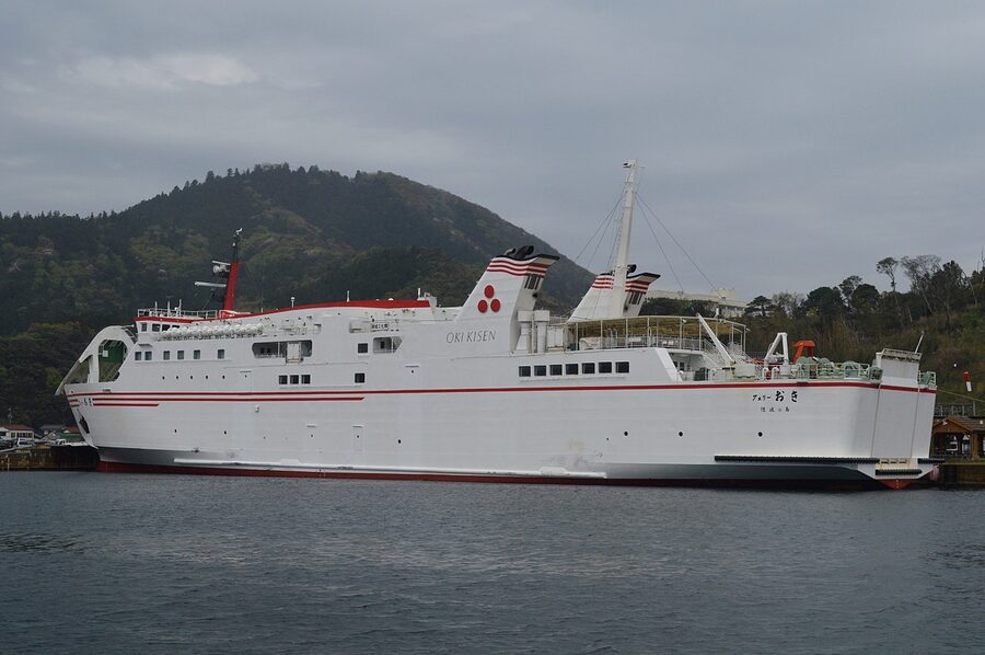
The Oki Islands are remote by Japan’s standards, and there is no way to get here without either a four-hour ferry or a small-plane flight.
By ferry. Oki Kisen operates the regular service. Two ferry classes run. The Ferry Oki and Ferry Kuniga are the large overnight-capable car-ferries: 2h 40min from Shichirui (Matsue area) or Sakaiminato (Yonago) to Saigō on Dōgo, ¥3,510 one-way. They run once a day in each direction. The Rainbow Jet high-speed catamaran does the same route in 1h 10min but costs ¥6,650 and only operates 03 2–3 round trips a day, weather-dependent.
Shichirui Port (near Matsue) is the most common departure point. Direct bus from Matsue Station to the port takes about 40 minutes, ¥1,100. From Izumo add an extra 30 minutes on the Ichibata line to Matsue first.
By air. JAC (a JAL subsidiary) operates small-prop flights from Izumo Enmusubi Airport to Oki Airport (on Dōgo). Flight time 30 minutes, 2–3 flights a day, about ¥15,000 one-way. Occasional Osaka Itami → Oki Airport direct flights (60 minutes, ¥22,000). This is the only practical access in winter when the ferry cancels often.
Inter-island transport. Oki Kisen also runs smaller ferries between the four inhabited islands. A same-day ticket (¥2,500) lets you hop two or three islands in one day. The Dōzen-to-Dōgo crossing is about 60 minutes; within Dōzen, inter-island crossings are 15–30 minutes each.
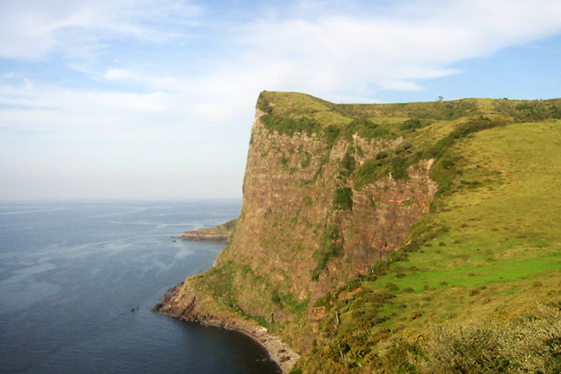
Nishinoshima and the Kuniga Coast
If you only visit one Oki island, make it Nishinoshima. The island’s northwest coast — the Kuniga Coast (国賀海岸) — is one of the most dramatic stretches of shoreline in Japan.
The coast is walkable. There’s a proper 2.3-kilometre hiking trail from the Akao parking (reachable by infrequent bus or taxi from Beppu Port) that follows the clifftop to a small shrine at the top of Matengai, then descends the east ridge back to the main road. It takes about 90 minutes at a normal pace. No shade. Carry water.
Nishinoshima also has a sea-tour boat — the Kuniga Meguri — that takes you right up under the cliffs from the sea side. This is the only way to see the cliff faces properly; from the clifftop, you’re looking straight down, and you don’t get a sense of scale. The boat is 70 minutes, ¥3,500, and runs four times a day from April to October (weather dependent). Book ahead; the winter boats do operate but only when conditions allow.
Stay at least one night on Nishinoshima if you can. The sunset over the Kuniga cliff from Akao viewpoint is one of the best in the San’in region.
Why the cliffs look like that: the Oki geology
The Oki Islands are a UNESCO Global Geopark, which sounds like marketing but actually reflects something genuinely unusual about the place. The islands are the eroded remnants of volcanic activity spread across 6.3 million years — not one event, but three separate volcanic episodes, each producing different rock types. You see that layering in the Kuniga cliffs: ash beds, lava flows, and intruded magma columns stacked against each other.
A few specific things to look for. The Tenjōkai pillars east of Matengai are vertical basalt columns that formed when magma intruded into older rock and cooled slowly from all sides, shrinking into hexagonal columns. The Akao beach exposes thin red sediment layers that contain fossilised Miocene-era plant material — you can see leaf impressions in the rock if you know what to look for. The Akiya cave on the west coast of Nishinoshima is a sea cave cut by wave action into a cooled lava flow, making a tunnel wide enough to kayak into.
The geopark visitor centre at Saigō Port (Dōgo Island) has a 45-minute film explaining all this with good English subtitles. If you’re going to spend multiple days on the islands, it’s the right first stop — it radically changes how you read the landscape afterwards.
A side note: the Oki Islands are one of the few places in Japan where the rocks above sea level are notably older than the rocks on adjacent mainland Honshū. The islands were separated from the mainland sometime in the late Pleistocene, and before that were connected — when you’re on Oki, you’re essentially standing on what used to be mountain peaks on a larger Honshū that extended further north into what’s now the Sea of Japan.
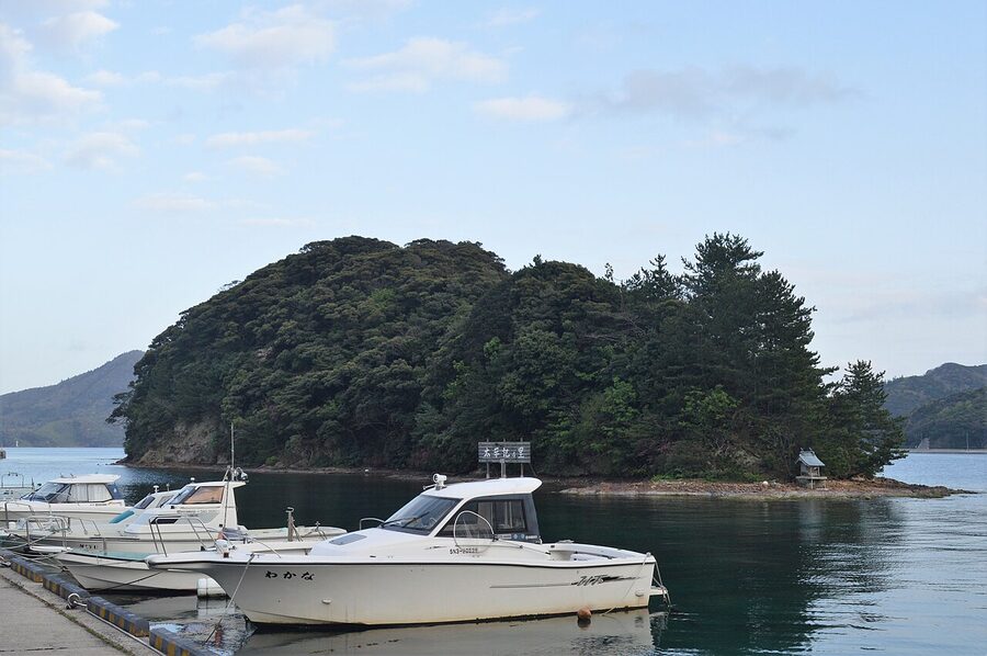
Nakanoshima: Ama town
The middle Dōzen island — officially “Nakanoshima,” but locally called Ama town after the administrative name — is the smallest of the four inhabited islands and the one that’s been most interesting culturally in the last decade. Ama has a population of about 2,300 people and has become Japan’s most successful small-island revival experiment, with a specific school-based “I-turn” programme that has convinced dozens of young families from Tokyo and Osaka to move here. The café, sake brewery, and town-centre shops are largely run by these new arrivals; there’s a genuine creative energy about the place that’s unusual in rural Japan.
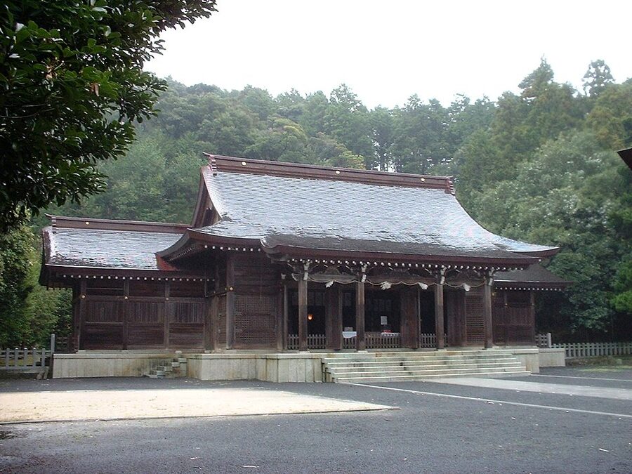
Ama is also where Emperor Go-Toba lived out his 19-year exile from 1221 to 1239. Oki Jinja — a Shinto shrine a short walk from Hishiura Port — is the shrine built on the site of his exile residence, and his grave is in the forest behind it. It’s simple, heavily atmospheric, and surprisingly moving for a quiet afternoon visit.
Also on Ama: the Goka-no-mura salt works (you can watch traditional seawater salt evaporation in a wood-fire kiln), the Oki Gyūten cattle farm (walk among the island’s free-range Japanese black beef herd), and the Kakurami Beach secluded swim spot. The town is walkable; rental bikes cost ¥1,000 for a full day.
Chiburijima: the red-cliff island
Chiburijima is the smallest and most remote of the four inhabited islands — population about 600, two ferry ports, one main road. The draw is the Sekiheki (赤壁, “red cliffs”) on the west coast — a long wall of oxidised iron-red volcanic rock that glows at sunset. The island also has one of the best-preserved active tagyū (bull sumo) traditions in Japan; matches are held four times a year in the summer months.
Chiburijima is a half-day visit from either Nishinoshima or Nakanoshima. A rental scooter or bicycle covers everything on the island. There’s one small guesthouse and a minshuku.
Dōgo: the main island
Dōgo is the single biggest Oki island (about 240 km², population 14,000) and has the main airport, the main ferry port at Saigō, and most of the accommodation. It also has its own distinctive landscapes.
Key spots: the Shirashima Coast (above) on the north side — white volcanic-tuff rock formations against the sea, an easy 30-minute walk from the parking area at Nakamura; the Rōsoku-jima (“candle rock”) off the northwest coast, a 40-metre spire that catches the setting sun directly on its tip like a lit candle at specific times of year (June and July are best); the Jōdogaura pebbled coast with its sea caves; and Tamawakasu-mikoto Jinja, one of the oldest shrines in the Oki group (founded supposedly in the 7th century).
Dōgo’s interior is mountainous and wooded — cedar forest, wild camellia in winter, the occasional wild sika deer. A circle drive of the whole island takes about 3 hours without stops, 6 hours with the main viewpoints included. Rental car is the right way to see Dōgo; there are rental agencies at both Saigō Port and the airport.
Food on the Oki Islands
Three things to eat.
Oki wagyu beef. The islands have been raising Japanese black beef for centuries. The cattle are mostly free-range on the open clifftops, which is unusual in Japan (most wagyu is stall-raised). The meat is leaner, grassier, and has a distinctive taste that wagyu purists either love or don’t. Oki Ushi-no-Ie restaurant in Saigō does a reliable ¥3,500 set.
Sazae (horned turban shell). Large spiral sea snails, grilled in their shells over charcoal, served with a soy-based dipping broth. A local speciality; you’ll see them on almost every menu. ¥600–¥900 per shell.
Iwagaki (rock oysters). The Oki rock oysters are a specific summer variety — larger than the Hiroshima Setouchi ones, creamier, with a shorter season (June–August). Served raw with lemon at seaside restaurants on Dōgo and Nishinoshima. See also our Hiroshima oysters guide for the winter Setouchi version.
Plus: Oki sake. The islands have three small breweries producing distinct styles; the Oki Shuzō brewery on Dōgo does tours and tastings.
Where to stay
Accommodation is limited and should be booked at least a month ahead in summer.
Entō Hotel. The new-in-2021 design-hotel on Ama (Nakanoshima) — opened as part of the island’s revival programme, sea-facing rooms, Japanese-Scandinavian minimalism. ¥30,000+ per person with half-board. Best option in the islands if the budget works.
Hotel Ocean. On Dōgo near Saigō Port. Mid-range business-hotel style with onsen baths. ¥12,000–¥18,000.
Marine Plaza Oki Nishinoshima. On Nishinoshima near Beppu Port. Functional, clean, ¥11,000 with breakfast.
Minshuku (family-run guesthouses). There are dozens across all four islands, typically ¥7,000–¥12,000 including two home-cooked meals. Bookable through the Oki Islands tourism office. The meal at a good minshuku will be the food memory you take home.
Planning your visit
Minimum 2 nights, 3 days. The travel time alone eats into a shorter visit. The right minimum is day one ferry over + Nishinoshima (Kuniga coast), day two inter-island ferry to Nakanoshima (Ama town + Oki Jinja), day three ferry back or a morning on Dōgo before the afternoon departure.
4 days / 3 nights. Add Chiburijima (half-day from Nishinoshima) and a full day circling Dōgo by rental car. This is the proper way to see the islands.
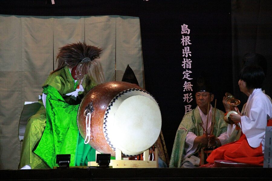
5+ days. Start adding kayak trips, the Oki-Dōzen kagura performances (summer only), sea-boat tours of the Matengai cliffs from below, and the tagyū bull sumo events on Chiburijima. Also becomes realistic to pair the Oki trip with Izumo and Matsue on the mainland into a week-long San’in loop.
When to go. May–October is the main season. The islands are stunning in midsummer, but a serious factor is that the Sea of Japan gets rough from November to March — ferry cancellations during those months run about 20–30% of scheduled sailings. If you’re going in winter, fly; budget an extra buffer day at each end.
Why the emperors weren’t really suffering
Stand on the summit of Matengai at 17:00 in late May. The island of Chiburijima is visible 4 km south, hazy blue. The Sea of Japan runs flat to the northern horizon. A grazing horse is about 30 metres to your left, entirely indifferent to you. The cliff drops 257 metres straight into the water; swallows ride the updraught along the face, barely flapping.
Go-Toba ruled Japan. He fought the Kamakura shogunate’s regent and lost. For that loss, they sent him here, and he stayed for nineteen years, and he died looking at this. His grave is on Ama, in the next cove over. There is a tradition that he wrote some of his finest waka poetry in that time — poetry about the sea, about the weather, about solitude that he had never really experienced before. Nothing in the poetry suggests suffering. Several of the later emperors preserved it as the classical canon of Japanese verse.
The Oki Islands were the last place in pre-modern Japan most people wanted to go. They are now one of the few remaining places in post-modern Japan worth the extra flight. Go once. You will understand what the emperors understood.