You arrive in Mihara and you realise the castle is the station. Not near it. Not beside it. The Shinkansen platform actually sits inside what used to be the keep, on top of stone ramparts laid down in 1567. It’s the strangest welcome any town in western Japan gives you, and almost nobody notices because the Kodama is the only bullet train that bothers to stop here.
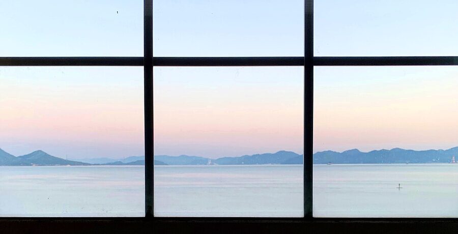
Mihara (三原) is a coastal city of about 91,000 people in eastern Hiroshima prefecture, sitting on the Seto Inland Sea roughly halfway between Hiroshima and Okayama. It’s a ferry hub, a castle town, a daruma-doll capital, and — if you ask a local — “umi, yama, sora”: sea, mountains, sky. The phrase comes up a lot here. You’ll understand why after an afternoon.
I’ll be honest: Mihara is not a place most foreign travellers pencil in. Hiroshima gets the peace memorial visitors, Onomichi gets the cycling crowd, Kurashiki gets the canal-town photo list. Mihara gets the people who had to change trains. That’s a mistake. This is the quiet, useful, slightly scruffy end of the Setouchi — the town where you can eat ramen for ¥1000, watch the ferries leave for the rabbit island, climb two small mountains for the best island view in the region, and end up drinking whisky in a jazz bar with no windows. In one day.
The castle that was built on the sea

.jpg)
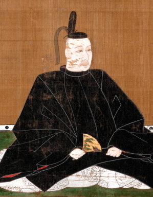
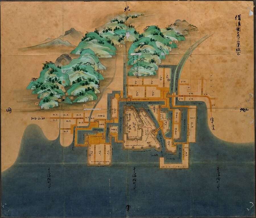
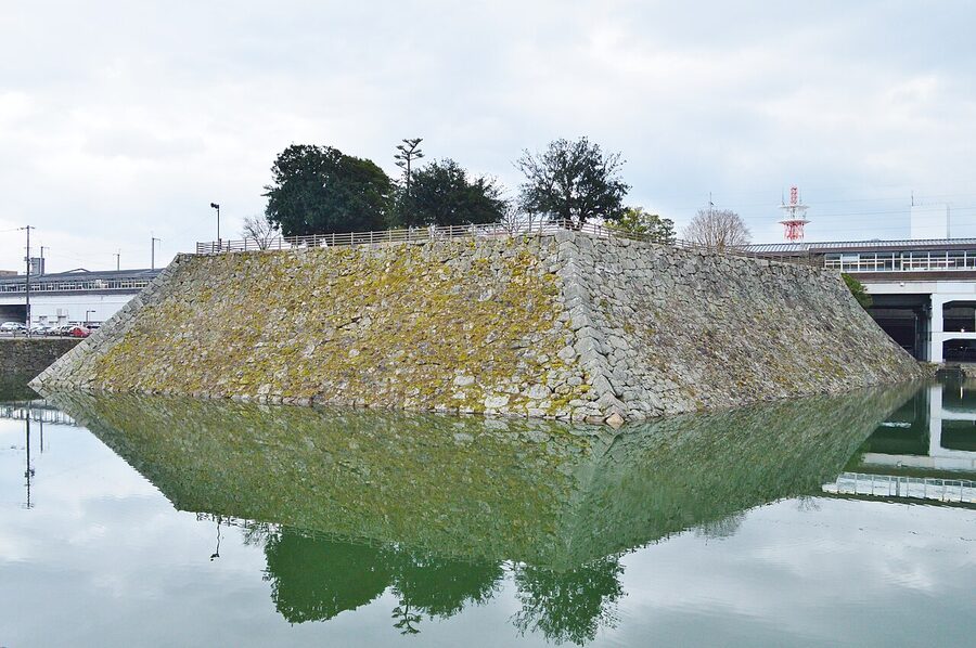
Mihara Castle (三原城) is what brought the town into being. In 1567 a warlord called Kobayakawa Takakage — third son of the Mōri clan’s chief strategist, Mōri Motonari — picked three islands in the middle of Mihara Bay and built a castle across them. Walls on the water. At high tide the place looked like it was floating, and contemporaries started calling it ukishiro, the floating castle. There are only a handful of these sea-fortresses in Japanese history. Mihara is one of the originals.
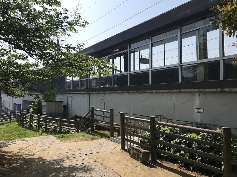
The castle itself is gone. The keep came down in the Meiji era, and when the San’yō railway was laid in the 1890s the engineers ran the tracks straight through the honmaru, the inner bailey. What you get today is the tenshudai — the stone base where the keep once stood — and a section of the old walls, and a square of water that used to be the inner moat. Mihara Station is built into the middle of it.
It’s a ten-second walk from the ticket gate. You go up a flight of stone stairs set into the wall, and you come out on a flat platform — the tenshudai — with views over the platforms and the city and, if the haze is cooperative, the sea. The platform is free to climb, open from 06:30 to 22:00, and almost always empty. If you arrive on the 30-minute Kodama ride from Hiroshima (about ¥3,500) you’ll have seen this view before you’ve even cleared the ticket gate. Do it straight away, before you head into town. The rest of Mihara starts making sense once you’ve seen where the original walls used to be.
There’s a small Mihara Castle museum in a replica turret on the south side of the station, and the Rekishi Kinenkan (歴史記念館) a few minutes’ walk east, which does a good job explaining Kobayakawa’s role in the Mōri-era politics of western Japan. Both are low-budget, both are worth the hour. Neither has much English signage, which is normal here — bring a translation app and a bit of patience.
The view that earns the climb: Fudekageyama and Ryuōsan
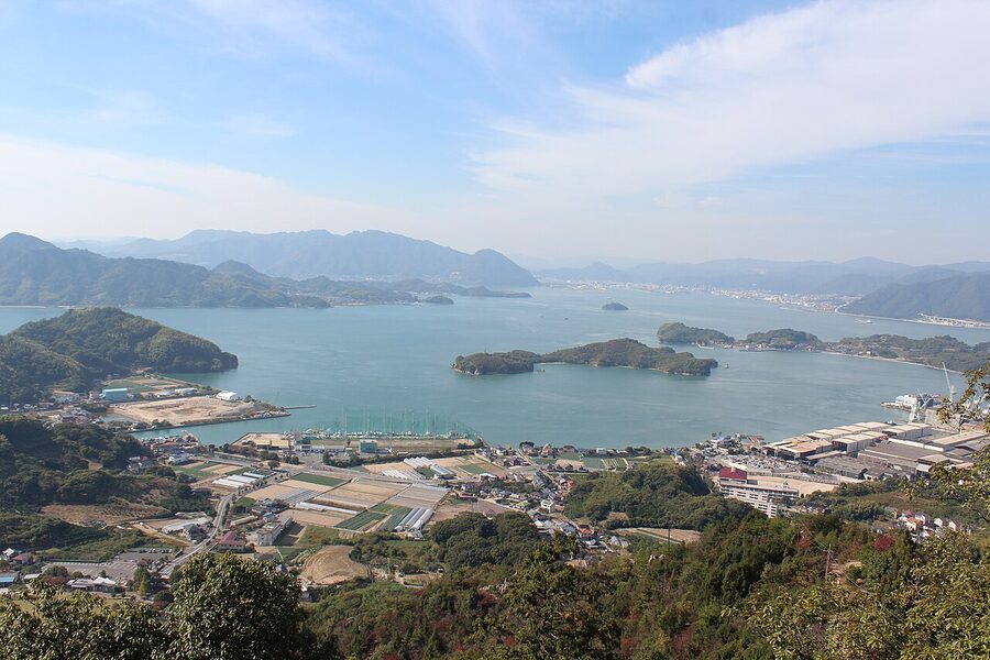
If you ask the tourist office what to do with a clear afternoon in Mihara, they’ll point you at two mountains south-west of the station. They’re both about 300 metres tall, which is exactly the right height — high enough for the island view, low enough that you won’t need more than a water bottle.
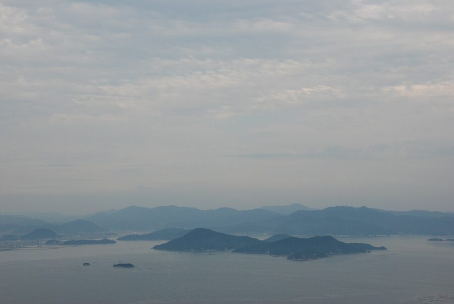
Fudekageyama (筆影山, 311 m) is the more famous one. Its name means “brush-shadow mountain” because in the right light the peak throws a shadow shaped like a calligrapher’s brush onto the sea. This is not marketing copy — locals genuinely know it by that name. The viewpoint near the summit looks directly south over the Shimanami chain of islands, and on a clear day you can pick out the mountains of Shikoku beyond. The viewpoint is reached by car, bus, or taxi (a taxi from the station is about ¥2,000) and there’s a walking trail from the Fudekage entrance if you fancy the climb — about 45 minutes up.
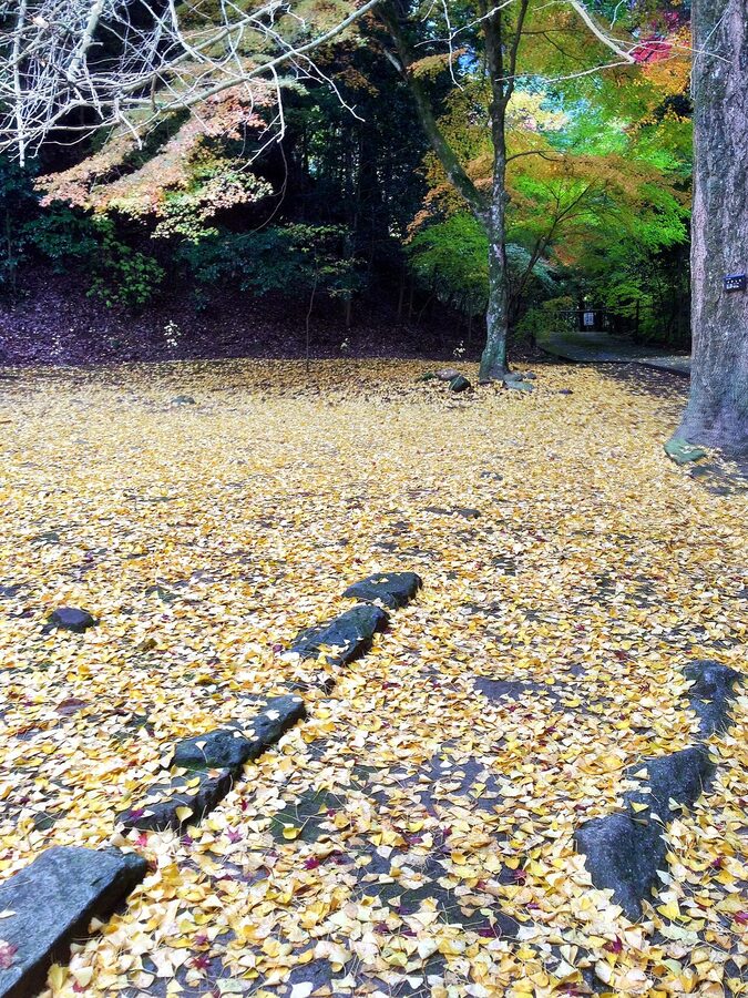
Ryuōsan (竜王山, 444 m) is the taller neighbour. There’s a 40-minute walking trail connecting the two peaks along the ridge, which is the quietly brilliant thing to do on a sunny afternoon. Cherry blossoms in April, red maples in November, island haze the other ten months of the year.
Mihara city technically includes both the inner town and a 470 km² stretch of coast and island that goes all the way to Hiroshima Airport. When you’re standing on Fudekageyama looking south, you’re essentially looking across “the rest of Mihara” — the islands of Sagi, Kosagi and the north half of the Shimanami chain are all administratively part of this city. For more on the geography of Setouchi and how these viewpoints fit the wider region, our landscapes of western Japan overview is a decent starting point.
Buttsuji Temple and the quiet half of the city
Inland Mihara is a completely different town from coastal Mihara. The coast is ports and trains and shop shutters painted with cartoons. The interior is rice fields, cypress forest, and temple grounds that can swallow an entire afternoon.

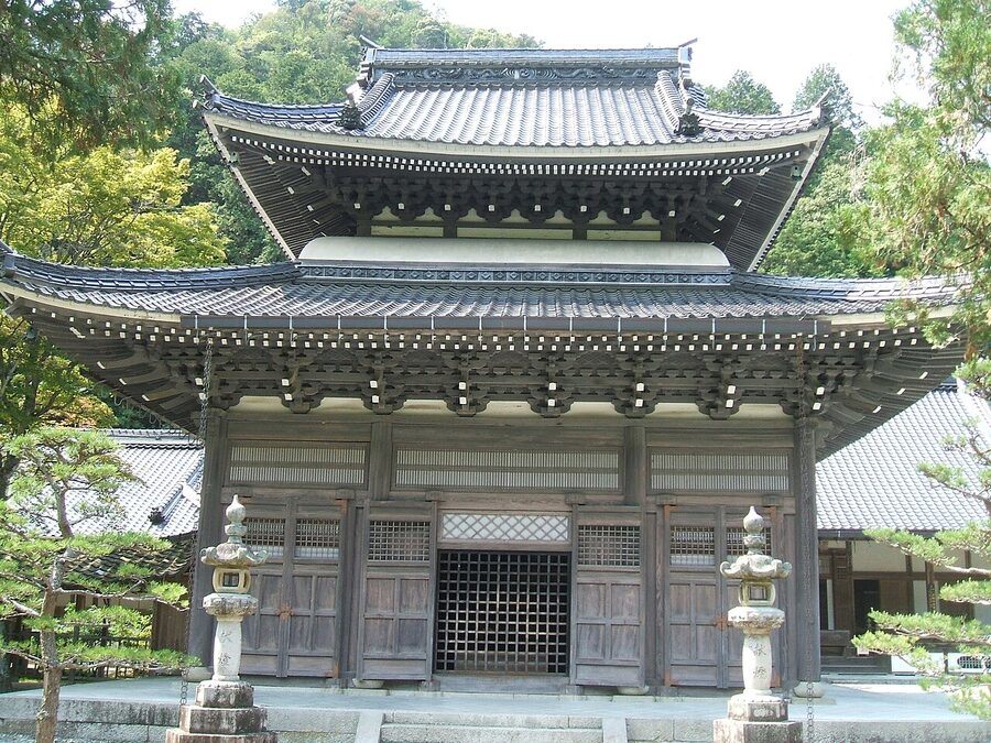
Buttsuji (仏通寺) was founded in 1397 by Gūchū Shūkyū, a Rinzai Zen monk, under the patronage of the Kobayakawa clan — yes, the same family that later built the castle. At its height it was the head temple of a sub-school of Rinzai Zen with 3,000 sub-temples across Japan. These days it’s a quieter place. The grounds still run to almost 30 square kilometres of mountain, which makes Buttsuji one of the largest temple forests in western Japan, and it’s still a functioning training monastery.
Two practical notes. First, the maples are genuinely excellent and almost completely unknown to foreign visitors — if you’ve been to the Momijidani on Miyajima during the autumn peak and found it shoulder-to-shoulder, Buttsuji in the same week will be the opposite experience. Second, the bus schedule is thin. Geiyō Bus runs from the stop outside Mihara Station to Buttsuji-mae, takes 35 to 40 minutes, and costs ¥720 one-way. But there are only four or five services a day. Miss the return bus and you’re either walking two hours to Hongō Station on the Sanyō line or calling a taxi. Write down the return times on your phone before you get on the outbound.
Otori Shrine and the sixty-six red torii
A five-minute walk from Mihara Station, up a short hill in the neighbourhood called Mihara-chō, is Otori Shrine (大歳神社) — sometimes Romanised as Ōtoshi. It’s an Inari shrine, which means foxes, rice, and red torii gates, and this particular one has sixty-six of them lined up along the path to the main hall. You walk the whole tunnel going up.
The obvious comparison is Fushimi Inari in Kyoto, and I’m not going to pretend it’s the same. Fushimi has thousands of gates; Otori has sixty-six. But Fushimi also has a queue and a selfie stick situation, and Otori has neither. I was there on a Saturday and walked through five people. The hilltop platform at the top is a good photo of the town below — red gates in the foreground, Seto Inland Sea in the distance. It’s free and it’s always open.
There’s a related curiosity about half an hour south of the station by bike: a small Inari shrine with its own uki-torii (floating torii) that sits in the water at high tide. Not the Miyajima Itsukushima one. A much smaller, much stranger private one. If you rent a bike from the tourist office (more on that below) the staff can draw the route for you.
Daruma, cream bread, and the small obsessions of Mihara
Mihara is the daruma-doll capital of Japan. This is not a tourist-office line — Gokurakuji Temple (極楽寺), twelve minutes’ walk east of the station, houses the Aoyama Collection, the country’s largest privately assembled daruma museum. Hundreds of dolls, from palm-sized votive figures to ones taller than a child, laid out in a room with almost no English labelling. Admission is free. Walk up, take your shoes off, spend twenty minutes.
At the tourist information centre in the station building you can also paint a daruma. The workshop is ¥1,500 (last time I checked), takes about half an hour including drying time, and you get to keep the doll. The tradition, if you haven’t come across it: you paint in one eye when you set a goal, and the other eye when you achieve it. The half-painted dolls in shop windows around Japan are all jobs in progress.
And then there’s the cream bread. Hattendo (八天堂) is a Mihara bakery founded in 1933 that in the early 2000s reinvented itself around one product: kurīmu pan, a chilled cream-filled bun. It is now available in Tokyo station, in convenience stores, and at airport gift counters across Japan, but it started here. The original Hongō factory — Hattendo Cafelie, about half an hour from the station by car or bus — runs a bread-making workshop for ¥1,000 where you make two flavours, no reservation needed. If you’re on a tight schedule, the Hattendo shop at Mihara Station sells the same buns for ¥220 each. They need to be eaten the day you buy them. Don’t buy more than four.
For the craft fans: Mihara also produces a specific kind of hand-pulled noodle called Mihara sōmen, a washi-paper tradition that’s almost gone, and a sake called Zuiyō (醉心) that was once the favourite drink of the Nihonga painter Yokoyama Taikan. The Zuiyō brewery is in Hongō and does tastings on weekends — again, not something anyone will have told you about.
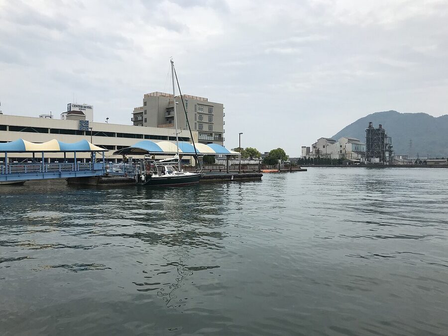
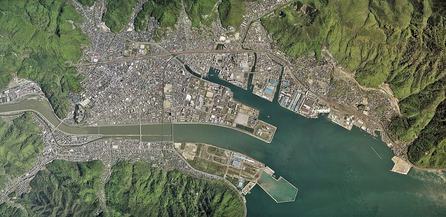
Mihara Port and the ferry game
The port is the other half of the reason to come here. Mihara and Sunami — two port areas within the city — are the cleanest launch points for the northern Shimanami islands if you’re not cycling the full Onomichi-to-Imabari route. There’s a Japanese-only timetable at the port office; these are the practical facts.
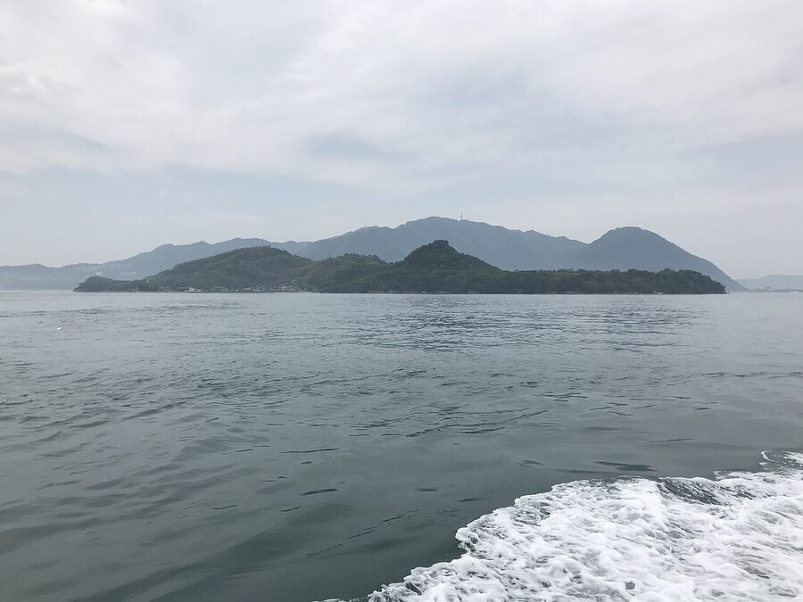
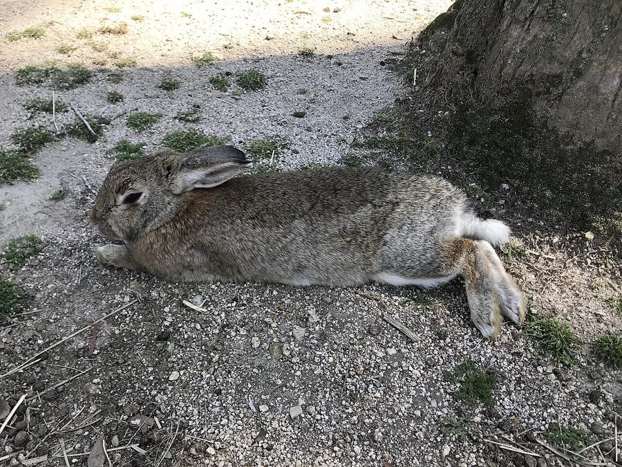
Okunoshima (Rabbit Island.) Weekends and holidays only from Mihara or Sunami; about 45 minutes. Every other day you need to take the Kure line one stop to Tadanoumi and go from there. Hundreds of feral rabbits, a former WWII poison-gas facility, one hotel. Goes full in cherry-blossom season. Go in winter or early morning if you want rabbits without other humans.
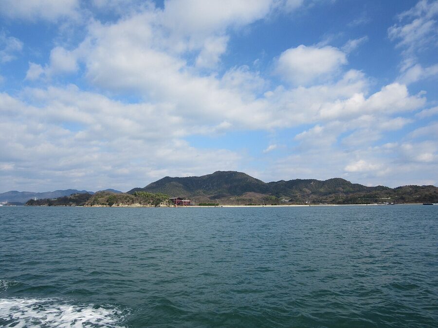
Ikuchijima (Setoda). Home of Kōsan-ji Temple, the so-called “Nikkō of the West” — a polychrome rebuild of famous Japanese temple structures that the founder commissioned in the 1930s in memory of his mother. Above it, the Hill of Hope: a 5,000-square-metre white marble sculpture garden that looks like somebody emptied a Greek quarry onto a Japanese hilltop. It’s divisive. I like it. Daily ferries from Mihara and Sunami, about 30 minutes.
.jpg)
Sagijima (Sagi Island). The 8.7 km² island that’s part of Mihara city but sits out in the Setouchi. There’s a walking circuit up Taiheizan (大平山), a “hill of a thousand cherry blossoms” (塔の峰千本桜), small sand beaches in the north, and a campground at Sagi Port. The ferry is twenty minutes, the last run back is around 17:30 — do not miss it. Bike rental on arrival, roughly ¥1,000 per half-day.
Kosagijima. The smaller island next to Sagi, 0.55 km², population around 50. You can day-trip here but there is nothing commercial on the island — pack water and lunch.
A practical tip the tourist board won’t give you: the Sunami ferries are often more relaxed than the Mihara Port ones, and the Sunami area itself is worth a wander — the shipyard turned winery (see below) is here. Sunami is five minutes south of Mihara Station on the Kure line, ¥190. Mihara’s local ferries and onward connections are detailed on the Miyajima and Setouchi islands page.
Where to eat and drink
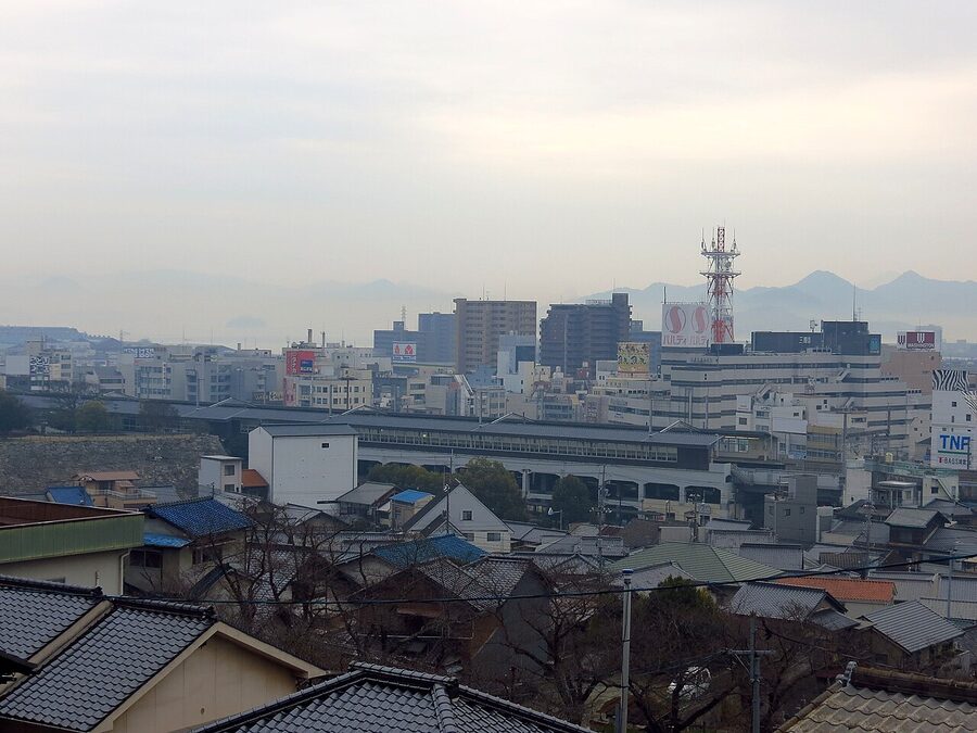
Most eating and drinking in Mihara happens in the pedestrian grid immediately south of the station — a couple of blocks of narrow streets called Minatomachi and Shiromachi, roughly the area the old castle walls used to enclose. It’s compact, walkable, and doesn’t show up on many guidebook maps.
Ramen Karen (ラーメン華蓮, 1-11-14 Shiromachi) — the default late-night stop. Fat-broth ramen, gyoza, cheap beer. Around ¥1,000 for a bowl and a drink. Local crowd, no English menu, open until most of the town has gone home.
Franky (フランキー, 1-6-16 Minatomachi) — don’t let the name fool you. It’s an izakaya with an unexpectedly long wine list and Mediterranean small plates that are actually good. A third of the menu is Japanese-grandmother food; the other two-thirds are not. Smoking permitted, which is a thing to know going in.
AGITO (アジト, 1-4-13 Minatomachi) — Italian-style izakaya. Pasta, pizza, but served small-plate with sake on the side. The risotto is the order.
Hito to Nomidokoro Uchūya (人と呑所 宇宙屋, 1-6-36 Minatomachi) — the “just let the owner choose” place. He’ll ask your budget, he’ll bring you food. The raw liver is an acquired taste; the potato salad is not. Probably speaks some English; mostly doesn’t need to.
Mukai Seipan (ムカイ製パン, 1-23-1 Sunami) — bakery in Sunami worth the short train ride. Table bread, baguette, and a fried-fish sandwich made from bream caught off the local coast. They open early, they’re sold out by 16:00. Get there before 14:00.
Setouchi Winery / Restaurant Mio (瀬戸内醸造所, 1-5-26 Nishi Sunami) — the splurge. Former shipyard, water-level terrace, house-made wine from Hiroshima-grown grapes, and a set lunch or dinner menu that leans into Setouchi seafood. Expect ¥7,000 at lunch and more at dinner. About ¥2,000 by taxi from Mihara Station, or a 20-minute walk from Sunami Station plus a short climb. Reservations essential at weekends.
For drinking after dinner, the three worth knowing are Carlton (カールトン, jazz, no windows, good whisky list), Grand Cafe (グランカフェ, the Rolling Stones will be playing, the owner is a musician and knows everyone), and Tachinomi Hiro-chan (立ち呑み hiro-chan, the craft-beer standing bar, fried skewers if you want them). All within five minutes of each other in Shiromachi.
One more note: Hiroshima prefecture is the oyster heart of Japan, and Mihara is inside the oyster belt. In season — November to March — almost every izakaya in town will have a blackboard kaki-fry (breaded fried oyster) or kaki-nabe (oyster hotpot) special. The oysters here come from the rafts you can see off Kosagi and Sagi islands. They’re smaller than the Matoya ones from Mie but sweeter.
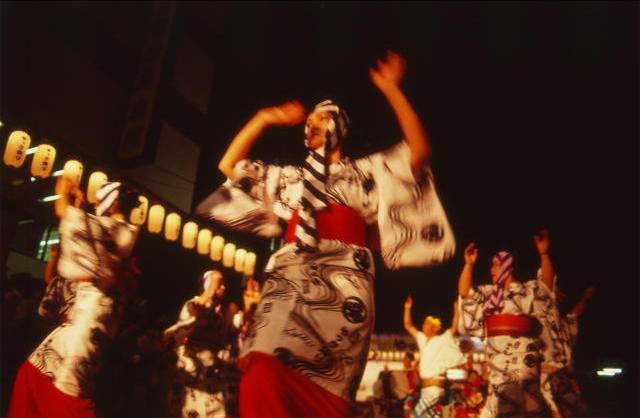
Yassa Matsuri: when Mihara dances
For three days in mid-August — the second weekend is the standard — the entire town shuts down for Yassa Matsuri, one of south-eastern Hiroshima’s largest festivals. It commemorates Kobayakawa Takakage’s founding of Mihara. What that actually looks like: several thousand dancers in yukata doing the yassa step (it’s a specific hand-and-foot pattern that takes about ten minutes to learn, which they’ll teach you on the street), portable shrines, a night parade, and a large fireworks show over the harbour on the Sunday.
If you happen to be in western Japan in mid-August — Obon season — and you can’t find a hotel in Hiroshima city (you won’t), Mihara is where to look. It’s also a better festival than the Hiroshima city one, at least in my opinion, because it’s still mostly for locals.
Getting to Mihara
.jpg)
By Shinkansen. Mihara Station is on the San’yō Shinkansen but only the Kodama service stops here — not the Nozomi, not the Sakura. From Hiroshima, the Kodama takes 30 minutes and costs about ¥3,500 reserved. From Tokyo, the fastest combo is Nozomi to Fukuyama (3h 50) then either Kodama or a local to Mihara (20 min). You can technically take the Kodama all the way from Shin-Osaka but it’s hours longer — don’t.
By local train. The Sanyō main line runs through Mihara: from Hiroshima via Saijō and Higashi-Hiroshima it’s about 90 minutes for ¥1,520. The Kure line branches off and loops along the coast via Takehara and Kure — much slower, much more scenic, and the best way to arrive if you have time.
By air. Hiroshima Airport (HIJ) is technically inside Mihara city limits — it sits on a plateau north of the city. The airport bus to Mihara Station takes 40 minutes and costs ¥900. The bus to Hiroshima city is faster and more frequent, so most flights route that way, but if you’re starting a Setouchi trip from Mihara the airport bus is cleaner than a Shinkansen transfer.
By bike. Bike rental is at the tourist information centre at the station: regular, electric, race, or child bikes for ¥1,000–2,000 per day. Open from 08:00 to 17:00 — the bikes must come back by closing time, and the staff will scan your passport or driving licence as a guarantee. It’s the single best investment for a day in Mihara.
Where to stay
Most Mihara hotels are business-class: practical, near the station, ¥7,000–10,000 a night for a solo room. Two have more character than the rest.
Yamane Inn (山根旅館, 1-14-21 Shiromachi) is the traditional option — a family-run ryokan five minutes from the station with tatami rooms, shared bath, and a breakfast that feels like somebody’s grandmother made it (because somebody’s grandmother did). Rooms go for ¥8,000–12,000 including breakfast; reservations by phone or Jalan.
Hotel Suehiro (ホテル寿恵広, 1-4-5 Sunami Nishi) is the modest seaside alternative. Basic but clean, in Sunami near the port, with a few sea-facing rooms at a slight premium. Handy if your first move is the morning ferry.
For something nicer, most travellers base in Hiroshima or Onomichi and day-trip in. Onomichi is fifteen minutes east by local train and has a better range of guesthouses; Hiroshima city is thirty minutes west on the Kodama.
Planning your visit
If you have half a day: train in to Mihara Station, climb the tenshudai, walk the izakaya grid, eat ramen at Karen, train out. Good for anyone passing through on the Kodama anyway.
If you have a full day: morning ferry to Okunoshima (if it’s weekend) or Sagijima, back for a late lunch, afternoon up Fudekageyama by bike or taxi, izakaya dinner, last train out. This is the classic Mihara day.
If you have two days: add Buttsuji Temple on the second morning (check the bus times before you commit), then an afternoon in Sunami with a late lunch or early dinner at Setouchi Winery Mio.
If you have three: use Mihara as a base and add Takehara’s Edo-era townscape (25 minutes west on the Kure line) and Onomichi for the cable-car view and Senkō-ji (15 minutes east on the Sanyō main line). Mihara’s cheaper hotels and less tourist-heavy restaurants make it a better base for this kind of slow itinerary than staying in Onomichi itself.
A few practical truths about Mihara
English signage is limited. The tourist office hands out an eight-page English pamphlet that covers the basics; beyond that you’ll want a translation app for menus, bus timetables, and ferry schedules. The locals are friendly about it — I’ve had bar owners hand-draw me maps on the back of a coaster — but you will need to make the first move.
Credit cards are patchy. Izakayas, ramen counters, ferry tickets, and bus fares are cash. There’s a 7-Eleven ATM in the station building that accepts foreign cards.
Bus schedules are thin outside the city centre. Inland Mihara is a 40-minute-bus country — Buttsuji, Sankeien Garden (by the airport), the airport itself — and services can be as few as three a day. The Google Maps transit layer is reasonably accurate but always screenshot the return time before you go.
The pronunciation that matters: it’s MI-ha-ra, three flat syllables, and the jo in “Mihara-jo” (the castle) is short. You’ll occasionally see it as “Bihara” on older foreign transliterations — it’s the same place.
The thing I almost forgot to mention
One more thing, because nobody writes it down: Mihara Station’s platform one — the Kure-line platform — is the only Shinkansen-era JR platform in Japan where you can stand and see a castle moat on one side and a flat sea on the other. It’s the whole town in one frame. Next time you’re waiting for the 06:49 Kodama to Hiroshima, stand right at the end of the platform. Five minutes. It’s the best postcard you’ll take.